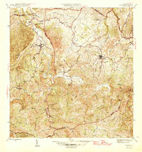
1946 Map of Ciales
USGS Topo · Published 1946About this map
The mountain town of Ciales sits at the heart of this mid-century interior survey, overlooking the winding Río Grande de Manatí. This 1940s landscape is defined by its agricultural and spiritual centers, where coffee haciendas and churches serve as the primary social anchors. To the east, the settlement of Morovis is a major hub, connected by a network of steep trails and the Linea de Transmision that follows the ridge lines. The rugged topography is etched with dozens of named streams like Quebrada Grande de Morovis and Quebrada Saliente, which fed the irrigation and domestic needs of localized farms such as Hacienda Maria. Institutional life is documented through landmarks like the Escuela Segunda Unidad de Pesas and numerous religious sites, including Iglesia Ascensión and Capilla del Carmen, illustrating the community structure before modern urbanization transformed the central cordillera.
Find a feature on this map
50 named features on this map. Tap any name to fly to it.
Don’t see what you’re looking for? This feature index may not catch every label — zoom into the map to look around manually.
Map Details
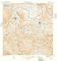
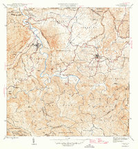
Editions of this 1946 Ciales Map
3 editions found
Other maps of this area

1937 · Aguadilla
USGS Topo · 1:20,000

1937 · Moca
USGS Topo · 1:20,000

1938 · Alto Sano
USGS Topo · 1:20,000

1938 · San Sebastian
USGS Topo · 1:20,000

1938 · Quebradillas
USGS Topo · 1:20,000

1939 · Mayaguez
USGS Topo · 1:30,000

1941 · Moca
USGS Topo · 1:30,000

1941 · Rincon
USGS Topo · 1:30,000

1941 · Rincon
USGS Topo · 1:30,000

1941 · San Sebastian
USGS Topo · 1:30,000
Featured Places
- Sector Serrano, San Sebastián
- Sector La Grúa, Añasco
- Sector Los Crespos, San Sebastián
- Sector Ramos, San Sebastián
- Sector Los Ramos, Moca