
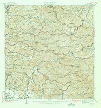
1942 Map of Rosario
USGS Topo · Published 1942About this map
The hills of Bosque Insular de Maricao dominate the landscape of western Puerto Rico in the late 1930s, showing a region defined by its steep terrain and agricultural estates. Numerous haciendas, including Hacienda Monita, Hacienda Esperanza, and Hacienda Corcega, are scattered across the mountainous ridges, connected by a network of trails and roads such as Carretera No. 16. The agricultural character of the era is evidenced by these family-named landholdings and the presence of several small chapels and churches like Iglesia de San Jose and the Capilla de la Milagrosa.
Find a feature on this map
76 named features on this map. Tap any name to fly to it.
Don’t see what you’re looking for? This feature index may not catch every label — zoom into the map to look around manually.
Map Details
Editions of this 1942 Rosario Map
3 editions found
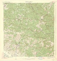
Other maps of this area

1935 · Puerto Real
USGS Topo · 1:25,000

1937 · San German
USGS Topo · 1:25,000

1937 · Sabana Grande
USGS Topo · 1:25,000

1937 · Puerto Real
USGS Topo · 1:25,000

1938 · Alto Sano
USGS Topo · 1:20,000

1938 · San Sebastian
USGS Topo · 1:20,000

1939 · Mayaguez
USGS Topo · 1:30,000

1941 · Rincon
USGS Topo · 1:30,000

1941 · San German
USGS Topo · 1:30,000

1941 · Puerto Real
USGS Topo · 1:30,000
Featured Places
- Sector Los Martinel, Las Marías
- Urb. Mansiones La Monserrate, Hormigueros
- Sector Coquí, Mayagüez
- Sector Punto Cubano, Hormigueros
- Sector Leclerc, Mayagüez