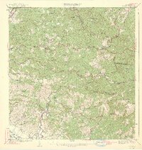
1942 Map of Rosario
USGS Topo · Published 1942About this map
Hacienda Juanita and other traditional agricultural estates dominate this interior landscape of western Puerto Rico during the early 1940s. The map illustrates a society defined by high-elevation coffee and sugar production, where named estates like Hacienda Esperanza and Hacienda Fajardo are the primary landmarks. The settlement of Rosario serves as a local hub, connected to the larger region by the American RR of Porto Rico and the Carretera America.
Find a feature on this map
69 named features on this map. Tap any name to fly to it.
Don’t see what you’re looking for? This feature index may not catch every label — zoom into the map to look around manually.
Map Details
Editions of this 1942 Rosario Map
3 editions found

Other maps of this area

1935 · Puerto Real
USGS Topo · 1:25,000

1937 · San German
USGS Topo · 1:25,000

1937 · Sabana Grande
USGS Topo · 1:25,000

1937 · Puerto Real
USGS Topo · 1:25,000

1938 · Alto Sano
USGS Topo · 1:20,000

1938 · San Sebastian
USGS Topo · 1:20,000

1939 · Mayaguez
USGS Topo · 1:30,000

1941 · Rincon
USGS Topo · 1:30,000

1941 · San German
USGS Topo · 1:30,000

1941 · Puerto Real
USGS Topo · 1:30,000
Featured Places
- Sector Ramón Román, Mayagüez
- Sector Los Limones, Mayagüez
- Sector Plan Bonito, Hormigueros
- Sector Punto Cubano, Hormigueros
- Urb. Jdn. de la Casona, Hormigueros