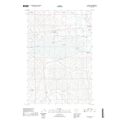
2020 Map of Central Park
USGS Topo · Published 2020About this map
The Chehalis River meanders through the heart of this landscape, its wide floodplain punctuated by riparian features such as Higgins Island and Bents Island. This drainage system is complex, fed by numerous sloughs and tributaries including Mox Chuck Slough, Peels Slough, and Blue Slough. The settlement pattern follows the valley's contours, with Central Park and Montesano serving as primary hubs of activity along the corridor.
Find a feature on this map
52 named features on this map. Tap any name to fly to it.
Don’t see what you’re looking for? This feature index may not catch every label — zoom into the map to look around manually.
Map Details
Editions of this 2020 Central Park Map
This is the sole edition of this map. No revisions or reprints were ever made.
Other maps of this area

1940 · Montesano
USGS Topo · 1:62,500

1941 · Mobray
USGS Topo · 1:62,500

1943 · Humptulips
USGS Topo · 1:62,500

1943 · Mobray
USGS Topo · 1:62,500

1953 · Hoquiam
USGS Topo · 1:250,000

1955 · Montesano
USGS Topo · 1:62,500

1955 · Wynoochee Valley
USGS Topo · 1:62,500

1955 · Humptulips
USGS Topo · 1:62,500

1955 · Aberdeen SE
USGS Topo · 1:24,000

1957 · Hoquiam
USGS Topo · 1:250,000