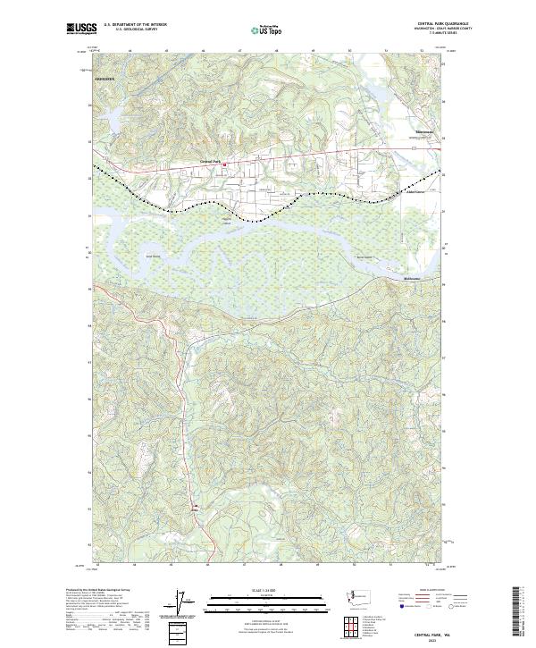
2023 Map of Central Park
USGS Topo · Published 2023About this map
Central Park serves as a residential corridor between the industrial hub of Aberdeen and the riverfront communities of the Chehalis valley. The landscape is defined by the intricate winding of the Chehalis River, which branches into a complex network of waterways including Mox Chuck Slough, Preachers Slough, and Blue Slough. These tidally influenced channels isolate landmasses such as Higgins Island and Sand Island, creating a unique wetland geography that has historically shaped local transit and development.
Find a feature on this map
55 named features on this map. Tap any name to fly to it.
Don’t see what you’re looking for? This feature index may not catch every label — zoom into the map to look around manually.
Map Details
Editions of this 2023 Central Park Map
This is the sole edition of this map. No revisions or reprints were ever made.
Other maps of this area

1940 · Montesano
USGS Topo · 1:62,500

1941 · Mobray
USGS Topo · 1:62,500

1943 · Humptulips
USGS Topo · 1:62,500

1943 · Mobray
USGS Topo · 1:62,500

1953 · Hoquiam
USGS Topo · 1:250,000

1955 · Montesano
USGS Topo · 1:62,500

1955 · Wynoochee Valley
USGS Topo · 1:62,500

1955 · Humptulips
USGS Topo · 1:62,500

1955 · Aberdeen SE
USGS Topo · 1:24,000

1957 · Hoquiam
USGS Topo · 1:250,000