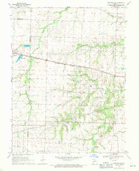
1969 Map of Centralia NE
USGS Topo · Published 1971About this map
The Gulf Mobile and Ohio and Norfolk and Western railroads dominate the landscape of the northeast Missouri prairie, converging near the growing settlement of Centralia. This 1960s-era survey reveals the transition from purely agricultural land to early suburban and industrial features, such as the Trailer Park and Drive-in Theater on the western edge of town.
Find a feature on this map
27 named features on this map. Tap any name to fly to it.
Don’t see what you’re looking for? This feature index may not catch every label — zoom into the map to look around manually.
Map Details
Editions of this 1969 Centralia NE Map
This is the sole edition of this map. No revisions or reprints were ever made.
Other maps of this area

1890 · Mexico
USGS Topo · 1:125,000

1890 · Moberly
USGS Topo · 1:125,000

1932 · Mexico
USGS Topo · 1:62,500

1945 · Florida
USGS Topo · 1:62,500

1945 · Centralia
USGS Topo · 1:62,500

1948 · Quincy
USGS Topo · 1:250,000

1953 · Moberly
USGS Topo · 1:250,000

1954 · Moberly
USGS Topo · 1:250,000

1956 · Quincy
USGS Topo · 1:250,000

1957 · Moberly
USGS Topo · 1:250,000