
1975 Map of Centralia NW
USGS Topo · Published 1978About this map
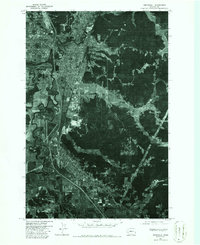
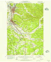
Centralia and its surrounding river valleys are captured in this 1975 orthophotograph, which provides a high-resolution aerial view of the landscape before major late-century expansion. The town site is bounded by the winding Skookumchuck River to the north and the broader Chehalis River to the west, creating a corridor of development that stretches south toward Chehalis. This imagery highlights the transition from the concentrated residential blocks and industrial zones of the urban centers to the open agricultural fields and wooded hillsides of Fords Prairie. The orthophoto format allows for the precise study of mid-1970s land use, showing the established rail lines, road networks, and river meanders that shaped the growth of these Lewis County communities during a period of steady Pacific Northwest development.
Find a feature on this map
5 named features on this map. Tap any name to fly to it.
Don’t see what you’re looking for? This feature index may not catch every label — zoom into the map to look around manually.
Map Details
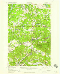
Editions of this 1975 Centralia NW Map
2 editions found
Other maps of this area

1916 · Chehalis
USGS Topo · 1:125,000

1940 · Tenino
USGS Topo · 1:62,500

1941 · Meskill
USGS Topo · 1:62,500

1941 · Gate
USGS Topo · 1:62,500

1944 · Tenino
USGS Topo · 1:62,500
1949 · Tenino
USGS Topo · 1:62,500

1953 · Hoquiam
USGS Topo · 1:250,000
1953 · Rochester
USGS Topo · 1:62,500
1953 · Adna
USGS Topo · 1:62,500
1954 · Centralia
USGS Topo · 1:62,500