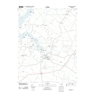
2011 Map of Centreville
USGS Topo · Published 2011About this map
The county seat of Centreville serves as the focal point of this Eastern Shore survey, where the Corsica River meets the surrounding agricultural landscape. The town's residential expansion is visible through developments like Tilghmans Terrace, Queen Annes Circle, and Kimberly Park, while its long history is preserved at the Chesterfield Cemetery and the central Centreville Post Office. Along the waterfront, Centreville Landing and Pusey Landing mark traditional points of access to the river's reaches, which are further defined by prominent landmarks like Jacobs Nose and Sycamore Point. Beyond the town center, the map documents a series of smaller crossroads and residential pockets such as Brownsville, Starkey Corner, and Burrisville. The northern portion of the quadrangle is dominated by the wide path of the Chester River, while the Church Hill Airport near Sparks Corner highlights the area's local infrastructure during the early 21st century.
Find a feature on this map
127 named features on this map. Tap any name to fly to it.
Don’t see what you’re looking for? This feature index may not catch every label — zoom into the map to look around manually.
Map Details
Editions of this 2011 Centreville Map
This is the sole edition of this map. No revisions or reprints were ever made.
Other maps of this area

1898 · Choptank
USGS Topo · 1:125,000

1898 · Tolchester
USGS Topo · 1:125,000

1899 · Dover
USGS Topo · 1:125,000

1901 · Chestertown
USGS Topo · 1:62,500

1903 · Tolchester
USGS Topo · 1:125,000

1904 · St. Michaels
USGS Topo · 1:62,500

1905 · Denton
USGS Topo · 1:62,500

1905 · Barclay
USGS Topo · 1:62,500

1906 · Dover
USGS Topo · 1:125,000

1908 · Tolchester
USGS Topo · 1:125,000