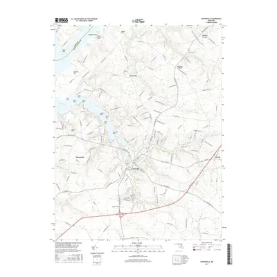
2017 Map of Centreville
USGS Topo · Published 2017About this map
Centreville serves as the focal point of this Eastern Shore landscape, situated where Mill Stream Branch and Gravel Run converge. The town's historical depth is visible through the Chesterfield Cem and a network of roads radiating toward peripheral settlements like Burrisville and Carville. To the north and west, the map detail follows the intricate tidal shorelines of the Chester River and Corsica River, revealing a series of named points and necks such as Spaniard Neck and Jacobs Nose. This coastal geography, defined by features like Mummys Cove and White Cove, illustrates the area's deep reliance on water access for agriculture and transport. The presence of Ashland Landing Farm Airport near Indian Town highlights the integration of aviation into the rural landscape, while crossroads like Browns Corner and Starkey Corner reflect the persistent importance of early transportation hubs.
Find a feature on this map
144 named features on this map. Tap any name to fly to it.
Don’t see what you’re looking for? This feature index may not catch every label — zoom into the map to look around manually.
Map Details
Editions of this 2017 Centreville Map
This is the sole edition of this map. No revisions or reprints were ever made.
Other maps of this area

1898 · Choptank
USGS Topo · 1:125,000

1898 · Tolchester
USGS Topo · 1:125,000

1899 · Dover
USGS Topo · 1:125,000

1901 · Chestertown
USGS Topo · 1:62,500

1903 · Tolchester
USGS Topo · 1:125,000

1904 · St. Michaels
USGS Topo · 1:62,500

1905 · Denton
USGS Topo · 1:62,500

1905 · Barclay
USGS Topo · 1:62,500

1906 · Dover
USGS Topo · 1:125,000

1908 · Tolchester
USGS Topo · 1:125,000