2023 Map of Centreville
USGS Topo · Published 2023About this map
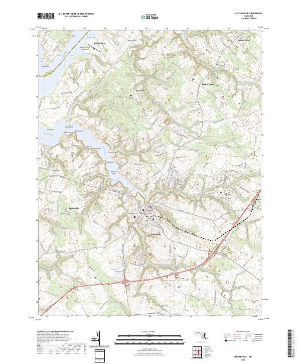
The Queen Anne's County Courthouse serves as the focal point of Centreville, a landscape defined by its intricate shoreline along the Corsica River and the Chester River. This 2023 survey illustrates a modern rural character, where large farm estates and agrarian lane names like Possum Point Farm Ln and Bloomfield Farm Ln reveal the enduring agricultural heritage of the Maryland Eastern Shore. Historically significant sites such as Indian Town and Burrisville remain key markers of early settlement patterns, while Chesterfield Cem and Mount Zion Cem offer localized points of interest for genealogists.
Find a feature on this map
144 named features on this map. Tap any name to fly to it.
Don’t see what you’re looking for? This feature index may not catch every label — zoom into the map to look around manually.
Map Details
Editions of this 2023 Centreville Map
This is the sole edition of this map. No revisions or reprints were ever made.