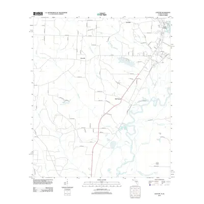
2012 Map of Century
USGS Topo · Published 2012About this map
The Escambia River meanders through the eastern portion of this landscape, its intricate oxbows and wetlands defining the border between Florida and Alabama. This 2012 survey captures a rural network of farm-to-market roads and small settlements situated on the high ground above the river's floodplain. Bluff Springs and Byrneville serve as central points for local commerce and community life, while Gandyville and South Flomaton sit at the northern edge near the state line. Genealogists and local historians will find the Carlney Cem positioned in the southeast, a quiet marker of the area's established families. The geography is further characterized by numerous water bodies like Lake Stone, Salters Lake, and Bluff Springs Lake, alongside several namesake drainages including McCostill Mill Cr and Pritchell Mill Br that hint at the region's milling history.
Find a feature on this map
90 named features on this map. Tap any name to fly to it.
Don’t see what you’re looking for? This feature index may not catch every label — zoom into the map to look around manually.
Map Details
Editions of this 2012 Century Map
This is the sole edition of this map. No revisions or reprints were ever made.
Other maps of this area

1941 · Century
USGS Topo · 1:62,500

1943 · Century
USGS Topo · 1:62,500

1943 · Jay
USGS Topo · 1:62,500

1953 · Andalusia
USGS Topo · 1:250,000

1957 · Andalusia
USGS Topo · 1:250,000

1957 · Pensacola
USGS Topo · 1:250,000

1959 · Pensacola
USGS Topo · 1:250,000

1960 · Pensacola
USGS Topo · 1:250,000

1960 · Atmore
USGS Topo · 1:24,000

1960 · Pollard
USGS Topo · 1:24,000