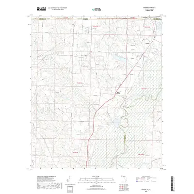
2018 Map of Century
USGS Topo · Published 2018About this map
The Escambia River defines the eastern boundary of this survey, carving a complex path of wetlands and oxbows through the borderlands of Florida and Alabama. This 2018 topographic study captures the northern reaches of Escambia County, where the historic timber and rail hub of Century sits just south of Flomaton and the state line. The landscape is a network of small creeks and branches, including Pritchell Mill Br and Canoe Cr, which drain into larger bodies like Lake Stone and the sprawling river basin.
Find a feature on this map
65 named features on this map. Tap any name to fly to it.
Don’t see what you’re looking for? This feature index may not catch every label — zoom into the map to look around manually.
Map Details
Editions of this 2018 Century Map
This is the sole edition of this map. No revisions or reprints were ever made.
Other maps of this area

1941 · Century
USGS Topo · 1:62,500

1943 · Century
USGS Topo · 1:62,500

1943 · Jay
USGS Topo · 1:62,500

1953 · Andalusia
USGS Topo · 1:250,000

1957 · Andalusia
USGS Topo · 1:250,000

1957 · Pensacola
USGS Topo · 1:250,000

1959 · Pensacola
USGS Topo · 1:250,000

1960 · Pensacola
USGS Topo · 1:250,000

1960 · Atmore
USGS Topo · 1:24,000

1960 · Pollard
USGS Topo · 1:24,000