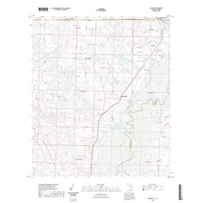
2021 Map of Century
USGS Topo · Published 2021About this map
Escambia River bottomlands dominate the eastern half of this 2021 landscape, marking the border between Escambia County and Santa Rosa County. The terrain is defined by the winding river channel and its complex network of seasonal water bodies like Salters Lake, Cartney Lake, and Williams Lake. To the west, the higher ground supports established settlements along the CSX Transportation rail corridor and North Century Boulevard. The town of Century sits as a primary hub, supported by smaller outlying communities such as Byrneville, where the Byrneville Sch remains a local landmark, and Bluff Springs further south. This modern survey illustrates the persistent rural-industrial character of the Florida-Alabama borderlands, showing how legacy infrastructure like the Pleasant Hill Ch and Cariney Cem coexist with newer landmarks like the Gandyville Fire Dept near the state line.
Find a feature on this map
145 named features on this map. Tap any name to fly to it.
Don’t see what you’re looking for? This feature index may not catch every label — zoom into the map to look around manually.
Map Details
Editions of this 2021 Century Map
This is the sole edition of this map. No revisions or reprints were ever made.
Other maps of this area

1941 · Century
USGS Topo · 1:62,500

1943 · Century
USGS Topo · 1:62,500

1943 · Jay
USGS Topo · 1:62,500

1953 · Andalusia
USGS Topo · 1:250,000

1957 · Andalusia
USGS Topo · 1:250,000

1957 · Pensacola
USGS Topo · 1:250,000

1959 · Pensacola
USGS Topo · 1:250,000

1960 · Pensacola
USGS Topo · 1:250,000

1960 · Atmore
USGS Topo · 1:24,000

1960 · Pollard
USGS Topo · 1:24,000