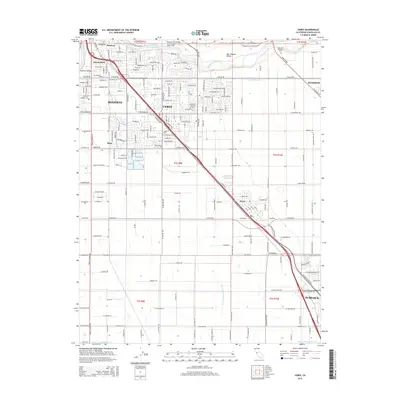
2015 Map of Ceres
USGS Topo · Published 2015About this map
The Tuolumne River winds across the northern edge of this San Joaquin Valley landscape, providing the lifeblood for an extensive irrigation network that includes the Ceres Main Canal and several lateral waterways. The city of Ceres serves as a central hub, flanked by the growing urban footprints of Modesto and Turlock. This 2015 snapshot illustrates a classic California agricultural corridor where residential expansion meets productive farmland, divided by the prominent corridor of Railroad Ave. Smaller residential pockets like Keyes, Shackelford, and Bystrom appear as established communities within the valley floor. In the eastern reaches, Lakewood Memorial Park and the edges of Hughson show the transition toward orchard lands. Local history researchers can trace the street grids of early neighborhoods like Harp or follow the paths of named roads such as W Hatch Rd and E Service Rd that define the region's rectilinear layout.
Find a feature on this map
109 named features on this map. Tap any name to fly to it.
Don’t see what you’re looking for? This feature index may not catch every label — zoom into the map to look around manually.
Map Details
Editions of this 2015 Ceres Map
This is the sole edition of this map. No revisions or reprints were ever made.
Other maps of this area

1915 · Westport
USGS Topo · 1:31,680

1915 · Salida
USGS Topo · 1:31,680

1916 · Mitchell School
USGS Topo · 1:31,680

1916 · Crows Landing
USGS Topo · 1:31,680

1916 · Riverbank
USGS Topo · 1:31,680

1916 · Denair
USGS Topo · 1:31,680

1916 · Waterford
USGS Topo · 1:31,680

1916 · Ceres
USGS Topo · 1:31,680

1917 · Turlock
USGS Topo · 1:31,680

1919 · Orestimba
USGS Topo · 1:62,500