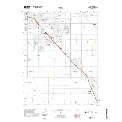
2018 Map of Ceres
USGS Topo · Published 2018About this map
The Tuolumne River winds through the northern portion of this Stanislaus County landscape, anchoring a region defined by its complex irrigation network and growing urban centers. In the late 2010s, the city of Ceres and south Modesto show a dense residential and commercial grid that transitions into the structured agricultural blocks of the Central Valley. Transportation and water infrastructure dictate the local layout, with the Ceres-Main-Canal cutting across the terrain toward Hughson. Smaller communities and neighborhoods such as Bystrom, Shackelford, and Parklawn cluster near the metropolitan edge, while more outlying settlements like Keyes and Cowan maintain distinct identities along the primary transit corridors. Landmarks like the Modesto City-County Airport-Harry Sham Field and Lakewood Memorial Park provide significant orientation points within this productive valley corridor.
Find a feature on this map
119 named features on this map. Tap any name to fly to it.
Don’t see what you’re looking for? This feature index may not catch every label — zoom into the map to look around manually.
Map Details
Editions of this 2018 Ceres Map
This is the sole edition of this map. No revisions or reprints were ever made.
Other maps of this area

1915 · Westport
USGS Topo · 1:31,680

1915 · Salida
USGS Topo · 1:31,680

1916 · Mitchell School
USGS Topo · 1:31,680

1916 · Crows Landing
USGS Topo · 1:31,680

1916 · Riverbank
USGS Topo · 1:31,680

1916 · Denair
USGS Topo · 1:31,680

1916 · Waterford
USGS Topo · 1:31,680

1916 · Ceres
USGS Topo · 1:31,680

1917 · Turlock
USGS Topo · 1:31,680

1919 · Orestimba
USGS Topo · 1:62,500