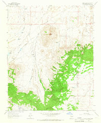
1963 Map of Cerro Alesna
USGS Topo · Published 1966About this map
Cerro Alesna rises as a prominent landmark over a landscape defined by traditional land grants and water management in the early 1960s. The map illustrates the complex boundary of the Bartolome Fernandez grant and its intersection with the Cibola National Forest. Human settlement is sparsely distributed, marked by the San Miguel Ranch and the historical remnants of Port San Miguel (Ruins) located along the upper reaches of San Miguel Creek.
Find a feature on this map
27 named features on this map. Tap any name to fly to it.
Don’t see what you’re looking for? This feature index may not catch every label — zoom into the map to look around manually.
Map Details
Editions of this 1963 Cerro Alesna Map
2 editions found
Other maps of this area

1883 · Mt. Taylor
USGS Topo · 1:250,000

1886 · Mt. Taylor
USGS Topo · 1:250,000

1892 · Mt. Taylor
USGS Topo · 1:250,000

1899 · Mt. Taylor
USGS Topo · 1:250,000

1958 · Albuquerque
USGS Topo · 1:250,000

1961 · El Dado
USGS Topo · 1:24,000

1961 · Piedra De La Aguila
USGS Topo · 1:24,000

1961 · El Dado Mesa
USGS Topo · 1:24,000
1961 · Laguna Canoneros
USGS Topo · 1:24,000
1961 · Mesa Cortada
USGS Topo · 1:24,000