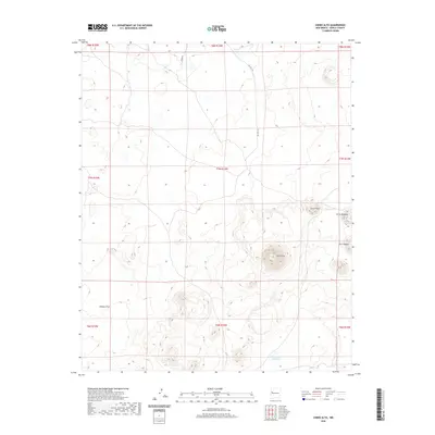
2020 Map of Cerro Alto
USGS Topo · Published 2020About this map
Cerro Alto rises as a prominent landmark in this section of Cibola County, anchoring a landscape defined by volcanic features and high-desert hydrology. The map illustrates a network of seasonal water bodies, most notably Laguna Flora and Laguna Colorada, which provide crucial water sources in this arid environment. The terrain is marked by distinct peaks such as Cerro Flora, Cerro Orqueta, and Cerro Negro, while the expansive Peñasco Flat occupies the western portion of the quadrangle. Transportation through this remote territory is facilitated by BIA Rte 143 and Ozark Rd, reflecting the infrastructure of the Eastern Navajo Agency. This 2020 survey documents the modern geographic state of the region, showing how traditional place names and land divisions continue to define the New Mexico landscape.
Find a feature on this map
18 named features on this map. Tap any name to fly to it.
Don’t see what you’re looking for? This feature index may not catch every label — zoom into the map to look around manually.
Map Details
Editions of this 2020 Cerro Alto Map
This is the sole edition of this map. No revisions or reprints were ever made.
Other maps of this area

1954 · Saint Johns
USGS Topo · 1:250,000

1957 · Saint Johns
USGS Topo · 1:250,000

1958 · Saint Johns
USGS Topo · 1:250,000

1962 · Saint Johns
USGS Topo · 1:250,000
1967 · Cerro Hueco
USGS Topo · 1:24,000

1967 · Red Lake Mission
USGS Topo · 1:24,000
1967 · Cerro Brillante
USGS Topo · 1:24,000

1967 · Chimney Hill
USGS Topo · 1:24,000
1967 · Goat Hill
USGS Topo · 1:24,000

1967 · Cerro Alto
USGS Topo · 1:24,000