
1963 Map of Cerro De La Olla
USGS Topo · Published 1967About this map
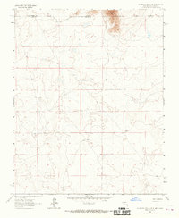
Cerro De La Olla dominates the high desert landscape of Taos County in this early 1960s topographic study. The massive shield volcano is the defining geological feature of the quadrangle, surrounded by the drainage patterns of Arroyo Punche and dotted with local landmarks like Cerro Negro. For local history researchers, the map identifies the isolated McGregor Place and a lonely Well at the base of the mountain, providing a specific record of land use in this arid region. The presence of a Jeep Trail winding near the volcanic slopes reflects the era's limited infrastructure and the reliance on rugged transport for ranching or surveying work in the high Taos plateau before significant modernization changed the character of the back-country access.
Find a feature on this map
6 named features on this map. Tap any name to fly to it.
Don’t see what you’re looking for? This feature index may not catch every label — zoom into the map to look around manually.
Map Details
Editions of this 1963 Cerro De La Olla Map
This is the sole edition of this map. No revisions or reprints were ever made.
Other maps of this area

1954 · Raton
USGS Topo · 1:250,000

1958 · Raton
USGS Topo · 1:250,000

1963 · Pinabetoso Peaks
USGS Topo · 1:24,000

1963 · Tres Piedras NE
USGS Topo · 1:24,000

1963 · Ute Mountain
USGS Topo · 1:24,000

1963 · Sunshine
USGS Topo · 1:24,000
1963 · La Segita Peaks NE
USGS Topo · 1:24,000
1963 · La Segita Peaks
USGS Topo · 1:24,000

1963 · Guadalupe Mountain
USGS Topo · 1:24,000
1963 · Tres Piedras
USGS Topo · 1:24,000