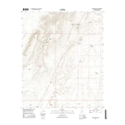
2017 Map of Cerro Montoso
USGS Topo · Published 2017About this map
The Los Pinos Mountains dominate this high-desert landscape in northern Socorro County, where massive volcanic and sedimentary features define the local geography. Significant peaks like Cerro Montoso and Cerro Pelon rise above a complex network of drainages, including Pelon Canyon and Pinon Canyon. The terrain transitions from the high peaks down through the Sepultura Flat and Grey Ridge, illustrating the arid landforms of central New Mexico.
Find a feature on this map
26 named features on this map. Tap any name to fly to it.
Don’t see what you’re looking for? This feature index may not catch every label — zoom into the map to look around manually.
Map Details
Editions of this 2017 Cerro Montoso Map
This is the sole edition of this map. No revisions or reprints were ever made.
Other maps of this area

1916 · La Joya
USGS Topo · 1:125,000

1952 · Black Butte
USGS Topo · 1:24,000

1952 · Becker SW
USGS Topo · 1:24,000

1952 · Becker
USGS Topo · 1:24,000

1952 · Cerro Montoso
USGS Topo · 1:24,000

1954 · Socorro
USGS Topo · 1:250,000

1958 · Socorro
USGS Topo · 1:250,000

1962 · Socorro
USGS Topo · 1:250,000
1972 · Sierra Larga North
USGS Topo · 1:24,000
1972 · Sierra De La Cruz
USGS Topo · 1:24,000