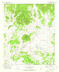
1972 Map of Cerro Prieto
USGS Topo · Published 1976About this map
Cerro Prieto rises from the high desert of western New Mexico, marking a landscape defined by cattle ranching and isolated water sources in the early 1970s. The map illustrates a sparse but essential network of family-held properties and infrastructure, including the Hubbell Ranch, Montaño Ranch, and Williamson Ranch. This era of land use is underscored by the density of named water points such as the Lucero Windmill, Tejana Windmill, and Dipping Vat Windmill, which served as the lifeblood for livestock in this arid environment.
Find a feature on this map
27 named features on this map. Tap any name to fly to it.
Don’t see what you’re looking for? This feature index may not catch every label — zoom into the map to look around manually.
Map Details
Editions of this 1972 Cerro Prieto Map
This is the sole edition of this map. No revisions or reprints were ever made.
Other maps of this area

1954 · Saint Johns
USGS Topo · 1:250,000

1957 · Saint Johns
USGS Topo · 1:250,000

1958 · Saint Johns
USGS Topo · 1:250,000

1962 · Saint Johns
USGS Topo · 1:250,000

1967 · Mariano Springs
USGS Topo · 1:24,000

1967 · Chimney Hill
USGS Topo · 1:24,000
1967 · Techado
USGS Topo · 1:24,000

1972 · Lake Armijo
USGS Topo · 1:24,000

1972 · Fence Lake
USGS Topo · 1:24,000

1972 · Tejana Mesa
USGS Topo · 1:24,000