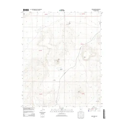
2013 Map of Cerro Verde
USGS Topo · Published 2013About this map
Cerro Verde and the high volcanic plateaus of Cibola County define this arid landscape, where geological landmarks rise sharply from the desert floor. The dominant mass of Black Mesa stands to the east, while the massive ridge of Sierra Lucero edges the southeastern portion of the quadrangle. This terrain is marked by seasonal drainage systems like Arroyo Colorado and deep cuts including Ponia Canyon and Rock Tank Canyon.
Find a feature on this map
18 named features on this map. Tap any name to fly to it.
Don’t see what you’re looking for? This feature index may not catch every label — zoom into the map to look around manually.
Map Details
Editions of this 2013 Cerro Verde Map
This is the sole edition of this map. No revisions or reprints were ever made.
Other maps of this area

1917 · Cerro Verde
USGS Topo · 1:125,000

1954 · Socorro
USGS Topo · 1:250,000

1956 · South Garcia
USGS Topo · 1:62,500

1956 · Mesa Aparejo
USGS Topo · 1:62,500

1958 · Socorro
USGS Topo · 1:250,000
1960 · South Butte
USGS Topo · 1:24,000
1960 · Dough Mountain
USGS Topo · 1:24,000

1960 · Cerro Verde
USGS Topo · 1:24,000

1961 · Marmon Ranch
USGS Topo · 1:24,000

1962 · Socorro
USGS Topo · 1:250,000