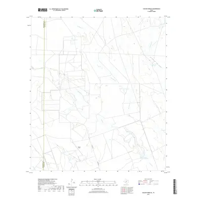
2019 Map of Chacon Creek SE
USGS Topo · Published 2019About this map
The Maverick and Zavala county line divides this South Texas landscape, where ephemeral waterways define the geography. Water management is central to this ranching country, evidenced by the presence of Cometa Lake, E O Jonsson Lake Number One, and named livestock watering points like Fourth of July Tank and Toro Tank. The drainage network includes Chacon Cr, Palo Blanco Cr, and the Arroyo de San Lucas, which cut through the dry terrain. Aviation and transit are represented by the Flying G Airport and Ranch Rd 2691, providing essential links to the settlement at Twin Lakes. This survey captures the rural infrastructure and land use patterns of the Brush Country as they existed in the late 2010s.
Find a feature on this map
15 named features on this map. Tap any name to fly to it.
Don’t see what you’re looking for? This feature index may not catch every label — zoom into the map to look around manually.
Map Details
Editions of this 2019 Chacon Creek SE Map
This is the sole edition of this map. No revisions or reprints were ever made.
Other maps of this area

1939 · Carrizo Springs
USGS Topo · 1:62,500

1939 · La Pryor
USGS Topo · 1:62,500

1940 · Cometa
USGS Topo · 1:62,500

1940 · Chacon Creek
USGS Topo · 1:62,500

1953 · Crystal City
USGS Topo · 1:250,000

1955 · Crystal City
USGS Topo · 1:250,000

1958 · Eagle Pass
USGS Topo · 1:250,000

1961 · Crystal City
USGS Topo · 1:250,000

1965 · Eagle Pass
USGS Topo · 1:250,000

1968 · Crystal City
USGS Topo · 1:250,000