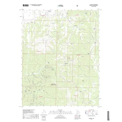
2017 Map of Chadwick
USGS Topo · Published 2017About this map
The southern Missouri settlement of Sparta and the hills of the Mark Twain National Forest define this landscape within Christian County. The terrain is deeply carved by a network of drainage basins, including Bull Cr and Swan Cr, which create the many hollows and ridges that characterize the area. In the central portion of the map, the village of Chadwick sits as a primary junction for local travel, surrounded by a high density of forest service roads and trails. Genealogists will find a significant distribution of family and community burial sites, from the Shipman Cem in the northwest to the Swansville Cem near Math Br in the south. The map also records early industry and access through names like Sawmill Hollow Rd and Bray Mine Rd, reflecting the region's historic reliance on timber and mineral extraction.
Find a feature on this map
127 named features on this map. Tap any name to fly to it.
Don’t see what you’re looking for? This feature index may not catch every label — zoom into the map to look around manually.
Map Details
Editions of this 2017 Chadwick Map
This is the sole edition of this map. No revisions or reprints were ever made.
Other maps of this area

1884 · Springfield
USGS Topo · 1:125,000

1886 · Springfield
USGS Topo · 1:125,000

1907 · Forsyth
USGS Topo · 1:125,000

1937 · Bradleyville
USGS Topo · 1:48,000

1937 · Ozark
USGS Topo · 1:48,000

1939 · Fordland
USGS Topo · 1:62,500

1942 · Fordland
USGS Topo · 1:62,500

1943 · Ozark
USGS Topo · 1:62,500

1943 · Bradleyville
USGS Topo · 1:62,500

1945 · Harrison
USGS Topo · 1:250,000