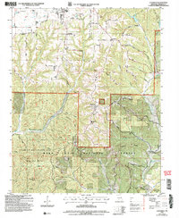
2004 Map of Chadwick
USGS Topo · Published 2006About this map
Chadwick and Oldfield anchor this portion of the Missouri Ozarks during the early 21st century, revealing a landscape defined by sharp ridges and deep hollows. The presence of Fairview Ch and the Chadwick Sch highlights the community hubs of the era, while numerous burial sites like Old Pioneer Cem, Boston Cem, and Shipman Cem offer vital clues for genealogical research.
Find a feature on this map
52 named features on this map. Tap any name to fly to it.
Don’t see what you’re looking for? This feature index may not catch every label — zoom into the map to look around manually.
Map Details
Editions of this 2004 Chadwick Map
This is the sole edition of this map. No revisions or reprints were ever made.
Other maps of this area

1884 · Springfield
USGS Topo · 1:125,000

1886 · Springfield
USGS Topo · 1:125,000

1907 · Forsyth
USGS Topo · 1:125,000

1937 · Bradleyville
USGS Topo · 1:48,000

1937 · Ozark
USGS Topo · 1:48,000

1939 · Fordland
USGS Topo · 1:62,500

1942 · Fordland
USGS Topo · 1:62,500

1943 · Ozark
USGS Topo · 1:62,500

1943 · Bradleyville
USGS Topo · 1:62,500

1945 · Harrison
USGS Topo · 1:250,000