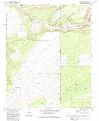
1971 Map of Chafin Well
USGS Topo · Published 1985About this map
Navajo Indian Reservation lands meet the Zuni Indian Reservation in this 1971 survey of the high desert borderlands. The map reveals a remote landscape where water is the primary arbiter of human activity and survival. Named features are largely centered on vital water sources, such as Chafin Well, C H Begaye Well, and the ironically named Good Luck Spring. These points of interest, connected by a network of Jeep Trails, served as essential landmarks for residents and travelers in the early 1970s.
Find a feature on this map
16 named features on this map. Tap any name to fly to it.
Don’t see what you’re looking for? This feature index may not catch every label — zoom into the map to look around manually.
Map Details
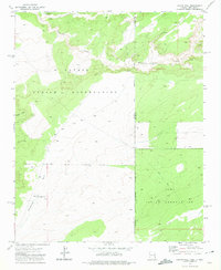
Editions of this 1971 Chafin Well Map
2 editions found
Other maps of this area

1886 · Wingate
USGS Topo · 1:250,000

1886 · Fort Defiance
USGS Topo · 1:250,000

1892 · Fort Defiance
USGS Topo · 1:250,000

1892 · Wingate
USGS Topo · 1:250,000

1954 · Gallup
USGS Topo · 1:250,000

1958 · Gallup
USGS Topo · 1:250,000

1959 · Gallup
USGS Topo · 1:250,000

1962 · Gallup
USGS Topo · 1:250,000

1963 · Jones Ranch School
USGS Topo · 1:24,000

1967 · Gallup
USGS Topo · 1:250,000