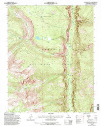
1994 Map of Chagoopa Falls
USGS Topo · Published 1997About this map
Chagoopa Plateau dominates the high-elevation landscape of Sequoia National Park in this mid-1990s survey. The dramatic vertical relief of the Sierra Nevada is clearly visible as the terrain drops sharply from the plateau into the Kern River Canyon, where the Kern River flows southward. Along the canyon floor, researchers can identify remote landmarks like the Kern Hot Spring and the expansive Funston Meadow.
Find a feature on this map
18 named features on this map. Tap any name to fly to it.
Don’t see what you’re looking for? This feature index may not catch every label — zoom into the map to look around manually.
Map Details
Editions of this 1994 Chagoopa Falls Map
This is the sole edition of this map. No revisions or reprints were ever made.
Other maps of this area

1903 · Tehipite
USGS Topo · 1:125,000

1904 · Kaweah
USGS Topo · 1:125,000

1905 · Tehipite
USGS Topo · 1:125,000

1905 · Olancha
USGS Topo · 1:125,000

1907 · Olancha
USGS Topo · 1:125,000

1907 · Mt. Whitney
USGS Topo · 1:125,000

1909 · Kaweah
USGS Topo · 1:125,000

1919 · Mt. Whitney
USGS Topo · 1:125,000

1937 · Mt. Whitney
USGS Topo · 1:125,000

1937 · Kaweah
USGS Topo · 1:125,000