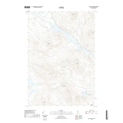
2018 Map of Chain of Ponds
USGS Topo · Published 2018About this map
Chain of Ponds anchors this mountainous landscape in Franklin County, where the topography rises sharply toward peaks such as Snow Mtn and Mt Pisgah. The map details a complex drainage system defining the borderlands of western Maine, including the high-altitude Snow Mountain Pond and the secluded Big Island Pond. Grounded in the logging and sporting traditions of the region, the survey shows a network of access points like Natanis Point Rd and Sports Camp Rd that weave between the steep slopes of Indian Stream Mtn and Bag Pond Mtn. The presence of the Around Pond Trl and the distinct formation of Delaware Gap illustrate the intersection of physical geography and recreational use in this backcountry terrain. From the northern reaches of Caribou Bog to the southern elevations of Toenail Ridge, the area remains dominated by its namesake water bodies and high ridgelines.
Find a feature on this map
29 named features on this map. Tap any name to fly to it.
Don’t see what you’re looking for? This feature index may not catch every label — zoom into the map to look around manually.
Map Details
Editions of this 2018 Chain of Ponds Map
This is the sole edition of this map. No revisions or reprints were ever made.
Other maps of this area

1928 · Chain Lakes
USGS Topo · 1:48,000

1931 · Cupsuptic
USGS Topo · 1:48,000

1932 · Kennebago Lake
USGS Topo · 1:48,000

1932 · Arnold Pond
USGS Topo · 1:48,000

1932 · Chain Lakes
USGS Topo · 1:62,500

1934 · Cupsuptic
USGS Topo · 1:62,500

1935 · Kennebago Lake
USGS Topo · 1:62,500

1935 · Chain Lakes
USGS Topo · 1:62,500

1935 · Cupsuptic
USGS Topo · 1:62,500

1935 · Arnold Pond
USGS Topo · 1:62,500
Featured Places
- Round Mountain, Alder Stream Township
- Kibby Township, ME
- Alder Stream Township, ME
- Seven Ponds Township, ME
- Chain of Ponds Township, ME