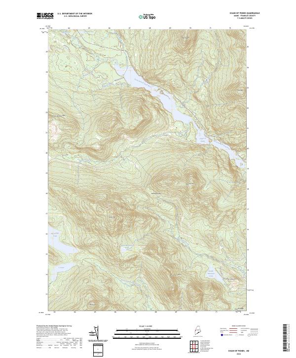
2024 Map of Chain of Ponds
USGS Topo · Published 2024About this map
Mt Pisgah and Sisk Mtn tower over a landscape defined by the winding waters of the North Branch Dead River and the interconnected lakes of the Chain of Ponds. This modern survey illustrates the enduring wilderness of Franklin County, where the terrain transitions from the expanse of Caribou Bog in the north to the sharp relief of Toenail Ridge in the south. The mapping of Delaware Gap between Bag Pond Mtn and Snow Mtn highlights the natural corridors used for travel through this high-elevation region. Local landmarks such as Big Island Pond and Round Mountain Pond serve as focal points for backcountry recreation, accessible via remote routes like Natanis Point Rd and Sports Camp Rd. The presence of numerous water bodies, including Snow Mountain Pond and Halfmile Brook, underscores the area's significance as a pristine headwater system.
Find a feature on this map
28 named features on this map. Tap any name to fly to it.
Don’t see what you’re looking for? This feature index may not catch every label — zoom into the map to look around manually.
Map Details
Editions of this 2024 Chain of Ponds Map
This is the sole edition of this map. No revisions or reprints were ever made.
Other maps of this area

1928 · Chain Lakes
USGS Topo · 1:48,000

1931 · Cupsuptic
USGS Topo · 1:48,000

1932 · Kennebago Lake
USGS Topo · 1:48,000

1932 · Arnold Pond
USGS Topo · 1:48,000

1932 · Chain Lakes
USGS Topo · 1:62,500

1934 · Cupsuptic
USGS Topo · 1:62,500

1935 · Kennebago Lake
USGS Topo · 1:62,500

1935 · Chain Lakes
USGS Topo · 1:62,500

1935 · Cupsuptic
USGS Topo · 1:62,500

1935 · Arnold Pond
USGS Topo · 1:62,500
Featured Places
- Kibby Township, ME
- Alder Stream Township, ME
- Chain of Ponds Township, ME
- Round Mountain, Alder Stream Township
- Seven Ponds Township, ME