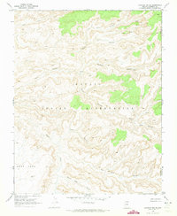
1970 Map of Chaiyahi Rim SE
USGS Topo · Published 1973About this map
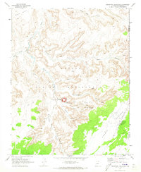
Navajo Indian Reservation lands in northern Arizona define this landscape of deep, intricate drainages and high plateaus. The 1970 field check recorded a complex network of seasonal watercourses and topographic landmarks, including the notable Cliff Dwelling sites tucked into the walls of Forty Caves Canyon. The terrain transitions from the broad Gray Mesa in the southwest toward the jagged reaches of Pyramid Canyon and Segito Canyon in the north. Movement through this high desert environment is marked by a traditional Pack Trail that connects remote springs and follows the natural contours of the land. The presence of several named Spring locations and Sand Creek emphasizes the importance of water sources within this arid canyon system, where the hydrology of Navajo Creek and its many tributaries has carved out a labyrinthine geography.
Find a feature on this map
18 named features on this map. Tap any name to fly to it.
Don’t see what you’re looking for? This feature index may not catch every label — zoom into the map to look around manually.
Map Details
Editions of this 1970 Chaiyahi Rim SE Map
This is the sole edition of this map. No revisions or reprints were ever made.
Other maps of this area

1883 · Marsh Pass
USGS Topo · 1:250,000

1892 · Marsh Pass
USGS Topo · 1:250,000

1956 · Marble Canyon
USGS Topo · 1:250,000

1959 · Marble Canyon
USGS Topo · 1:250,000

1961 · Marble Canyon
USGS Topo · 1:250,000
1970 · Tall Mountain NW
USGS Topo · 1:24,000
1970 · Chaiyahi Rim SW
USGS Topo · 1:24,000
1970 · Two Red Mesas
USGS Topo · 1:24,000
1970 · Inscription House Ruin
USGS Topo · 1:24,000
1970 · Chaiyahi Rim NE
USGS Topo · 1:24,000