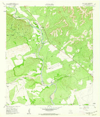
1960 Map of Chalk Bluff
USGS Topo · Published 1962About this map
The Nueces River carves a winding path through this corner of Uvalde County, where the topography shifts from the river bottom to the high ground of Chalk Bluff. In the early 1960s, this landscape was defined by its cattle ranching heritage, with large landholdings such as Bird Springs Ranch, Haby Ranch, and Bankier Ranch occupying the draws and creeks that feed the main river. The confluence of the West Nueces River and its primary branch occurs just south of Camp Chalk Bluff, creating a network of riparian zones vital for local agriculture. Transportation in the area relies on established landmarks like Haby Crossing, while the tracks of the T & N O RR cut across the southern edge of the survey, providing a heavy rail link for the rural community. Numerous intermittent drainages, including Elm Slough and Indian Creek, further illustrate the complex hydrology of the Edwards Plateau's edge.
Find a feature on this map
26 named features on this map. Tap any name to fly to it.
Don’t see what you’re looking for? This feature index may not catch every label — zoom into the map to look around manually.
Map Details
Editions of this 1960 Chalk Bluff Map
2 editions found
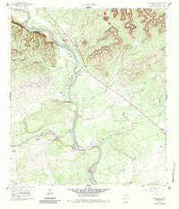
Other maps of this area

1896 · Brackett
USGS Topo · 1:125,000

1897 · Brackett
USGS Topo · 1:125,000

1898 · Uvalde
USGS Topo · 1:125,000

1899 · Uvalde
USGS Topo · 1:125,000

1938 · Turkey Mountain
USGS Topo · 1:48,000

1943 · Turkey Mountain
USGS Topo · 1:62,500

1949 · Cline
USGS Topo · 1:62,500

1954 · San Antonio
USGS Topo · 1:250,000

1957 · San Antonio
USGS Topo · 1:250,000

1958 · Del Rio
USGS Topo · 1:250,000