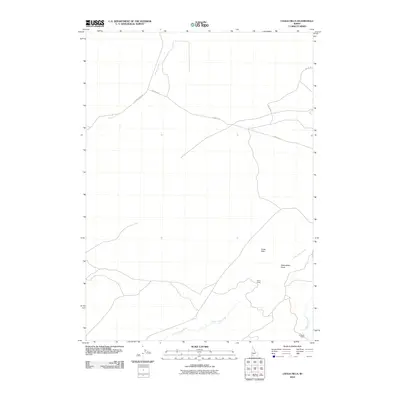
2010 Map of Chalk Hills
USGS Topo · Published 2010About this map
Chalk Hills defines the high-desert topography of this Owyhee County landscape, where water and transit have long dictated the patterns of human activity. The terrain is deeply inscribed by seasonal drainages such as Waterspout Draw, which feeds into the larger system of Little Jacks Creek and Big Jacks Creek. These watercourses provided the essential anchor for ranching operations in a dry environment, supporting established sites like Parker Ranch and the Al Sadie Ranch to the south.
Find a feature on this map
10 named features on this map. Tap any name to fly to it.
Don’t see what you’re looking for? This feature index may not catch every label — zoom into the map to look around manually.
Map Details
Editions of this 2010 Chalk Hills Map
This is the sole edition of this map. No revisions or reprints were ever made.
Other maps of this area

1946 · Mouth of Bruneau
USGS Topo · 1:24,000

1947 · Little Valley
USGS Topo · 1:24,000

1947 · Grand View
USGS Topo · 1:62,500

1947 · Bruneau
USGS Topo · 1:62,500

1947 · Grand View
USGS Topo · 1:24,000

1947 · Chalk Hills
USGS Topo · 1:24,000

1947 · Vinson Wash
USGS Topo · 1:24,000

1947 · Perjue Canyon
USGS Topo · 1:24,000

1948 · Perjue Canyon
USGS Topo · 1:24,000

1948 · Vinson Wash
USGS Topo · 1:24,000