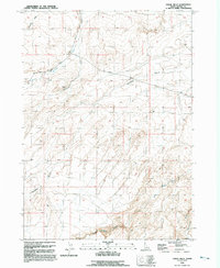
1992 Map of Chalk Hills
USGS Topo · Published 1992About this map
The Chalk Hills define this arid Owyhee County landscape, where deep drainage systems like Twentymile Gulch and Halfway Gulch carve through the high plateau. The map reflects a remote region structured by utility and resource extraction, notably an Open Pit Mine and a Gravel Pit situated near the network of rugged transport routes. Essential water sources for the area, including Shoofly Creek, Little Jacks Creek, and Big Jacks Creek, wind through the canyons, providing a vital contrast to the surrounding upland terrain.
Find a feature on this map
12 named features on this map. Tap any name to fly to it.
Don’t see what you’re looking for? This feature index may not catch every label — zoom into the map to look around manually.
Map Details
Editions of this 1992 Chalk Hills Map
This is the sole edition of this map. No revisions or reprints were ever made.
Other maps of this area

1946 · Mouth of Bruneau
USGS Topo · 1:24,000

1947 · Little Valley
USGS Topo · 1:24,000

1947 · Grand View
USGS Topo · 1:62,500

1947 · Bruneau
USGS Topo · 1:62,500

1947 · Grand View
USGS Topo · 1:24,000

1947 · Chalk Hills
USGS Topo · 1:24,000

1947 · Vinson Wash
USGS Topo · 1:24,000

1947 · Perjue Canyon
USGS Topo · 1:24,000

1948 · Perjue Canyon
USGS Topo · 1:24,000

1948 · Vinson Wash
USGS Topo · 1:24,000