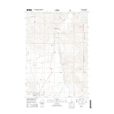
2013 Map of Challis
USGS Topo · Published 2013About this map
Challis serves as the focal point of this Custer County landscape, situated where the Salmon River meets the expansive Round Valley. The town grid, featuring streets like Main St and Pleasant Ave, sits at the base of the Salmon River Mountains, an area deeply carved by drainages such as Stephens Gulch and Gerry Gulch. To the south, the Challis Airport and Challis Hot Springs highlight the community's development along the valley floor, while the eastern edge is defined by the steep rises of the Challis National Forest.
Find a feature on this map
44 named features on this map. Tap any name to fly to it.
Don’t see what you’re looking for? This feature index may not catch every label — zoom into the map to look around manually.
Map Details
Editions of this 2013 Challis Map
This is the sole edition of this map. No revisions or reprints were ever made.
Other maps of this area

1929 · Bayhorse
USGS Topo · 1:125,000

1956 · Challis
USGS Topo · 1:62,500

1956 · Twin Peaks
USGS Topo · 1:62,500

1957 · Challis
USGS Topo · 1:250,000

1960 · Challis
USGS Topo · 1:250,000

1963 · Challis
USGS Topo · 1:250,000

1963 · Bayhorse
USGS Topo · 1:24,000
1963 · Little Antelope Flat
USGS Topo · 1:24,000

1963 · Clayton
USGS Topo · 1:62,500

1963 · Lone Pine Peak
USGS Topo · 1:62,500