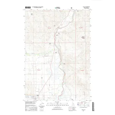
2017 Map of Challis
USGS Topo · Published 2017About this map
The town of Challis sits at the base of the Salmon River Mountains, where Garden Cr meets the broad flats of the Salmon River valley. This 2017 survey shows a landscape defined by its deep canyons and agricultural pockets, with the Challis National Forest bordering the eastern slopes. The town site includes the Po and the Challis Cem, while the modern infrastructure of the Challis Airport occupies the level ground of the valley floor.
Find a feature on this map
74 named features on this map. Tap any name to fly to it.
Don’t see what you’re looking for? This feature index may not catch every label — zoom into the map to look around manually.
Map Details
Editions of this 2017 Challis Map
This is the sole edition of this map. No revisions or reprints were ever made.
Other maps of this area

1929 · Bayhorse
USGS Topo · 1:125,000

1956 · Challis
USGS Topo · 1:62,500

1956 · Twin Peaks
USGS Topo · 1:62,500

1957 · Challis
USGS Topo · 1:250,000

1960 · Challis
USGS Topo · 1:250,000

1963 · Challis
USGS Topo · 1:250,000

1963 · Bayhorse
USGS Topo · 1:24,000
1963 · Little Antelope Flat
USGS Topo · 1:24,000

1963 · Clayton
USGS Topo · 1:62,500

1963 · Lone Pine Peak
USGS Topo · 1:62,500