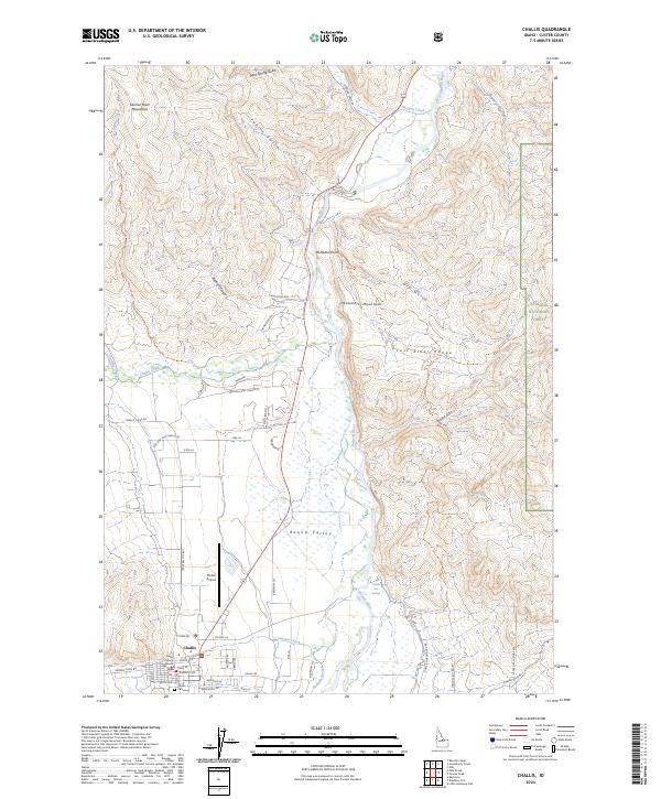
2024 Map of Challis
USGS Topo · Published 2024About this map
The Custer County Courthouse stands as the civic heart of Challis, positioned where the valley floor meets the rising slopes of the Salmon River Mountains. This 2024 survey captures the settlement’s layout along a grid of streets including North Ave and Main St, extending toward the Challis Cem on the town's southern edge. The landscape is defined by the broad Round Valley, a significant topographical depression bounded by the Pahsimeroi Mountains and the Lost River Range.
Find a feature on this map
56 named features on this map. Tap any name to fly to it.
Don’t see what you’re looking for? This feature index may not catch every label — zoom into the map to look around manually.
Map Details
Editions of this 2024 Challis Map
This is the sole edition of this map. No revisions or reprints were ever made.
Other maps of this area

1929 · Bayhorse
USGS Topo · 1:125,000

1956 · Challis
USGS Topo · 1:62,500

1956 · Twin Peaks
USGS Topo · 1:62,500

1957 · Challis
USGS Topo · 1:250,000

1960 · Challis
USGS Topo · 1:250,000

1963 · Challis
USGS Topo · 1:250,000

1963 · Bayhorse
USGS Topo · 1:24,000
1963 · Little Antelope Flat
USGS Topo · 1:24,000

1963 · Clayton
USGS Topo · 1:62,500

1963 · Lone Pine Peak
USGS Topo · 1:62,500