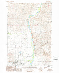
1989 Map of Challis
USGS Topo · Published 1989About this map
The Salmon River cuts through this high-altitude landscape of central Idaho, defining the eastern edge of Round Valley as it flows past the town of Challis. This late 1980s provisional survey shows a community tied to the land and the water, featuring infrastructure like the Challis Airport and Sewage Disposal Ponds alongside recreation and resource extraction. The area's geological and thermal activity is evidenced by Challis Hot Springs and a Gravel Pit near the riverbanks.
Find a feature on this map
30 named features on this map. Tap any name to fly to it.
Don’t see what you’re looking for? This feature index may not catch every label — zoom into the map to look around manually.
Map Details
Editions of this 1989 Challis Map
This is the sole edition of this map. No revisions or reprints were ever made.
Other maps of this area

1929 · Bayhorse
USGS Topo · 1:125,000

1956 · Challis
USGS Topo · 1:62,500

1956 · Twin Peaks
USGS Topo · 1:62,500

1957 · Challis
USGS Topo · 1:250,000

1960 · Challis
USGS Topo · 1:250,000

1963 · Challis
USGS Topo · 1:250,000

1963 · Bayhorse
USGS Topo · 1:24,000
1963 · Little Antelope Flat
USGS Topo · 1:24,000

1963 · Clayton
USGS Topo · 1:62,500

1963 · Lone Pine Peak
USGS Topo · 1:62,500