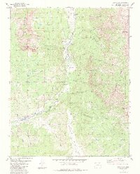
1984 Map of Chama Peak
USGS Topo · Published 1984About this map
The Continental Divide snake through this high-altitude landscape of the San Juan National Forest, where the headwaters of the Navajo River and Rio Chamita originate. In the mid-1980s, the terrain shows a mixture of resource extraction and water management, notably the Oil Field near the settlement of Gramps and the Oso Diversion Dam which feeds the Oso Tunnel. Natural features like Navajo Peak and Banded Peak dominate the skyline, while specialized alpine environments such as Virginia Meadow and Skeeter Park fill the high valleys.
Find a feature on this map
52 named features on this map. Tap any name to fly to it.
Don’t see what you’re looking for? This feature index may not catch every label — zoom into the map to look around manually.
Map Details
Editions of this 1984 Chama Peak Map
2 editions found
Other maps of this area

1913 · Summitville
USGS Topo · 1:125,000

1915 · Summitville
USGS Topo · 1:125,000

1945 · Durango
USGS Topo · 1:250,000

1953 · Durango
USGS Topo · 1:250,000

1954 · Durango
USGS Topo · 1:250,000

1954 · Aztec
USGS Topo · 1:250,000

1955 · Chama
USGS Topo · 1:62,500

1955 · Lumberton
USGS Topo · 1:62,500

1957 · Chromo
USGS Topo · 1:62,500

1957 · Chama Peak
USGS Topo · 1:62,500