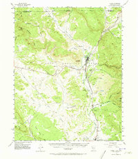
1955 Map of Chama
USGS Topo · Published 1973About this map
The Tierra Amarilla Grant forms the backdrop for this mid-century survey of the northern Rio Arriba country, where the Denver and Rio Grande Western railroad winds through the river valleys of the San Juan Mountains. The village of Chama serves as a central hub, featuring a High Sch, the Chama Ch, a Chama Cem, and a local Stockyard that reflects the area's agricultural and transit roots.
Find a feature on this map
43 named features on this map. Tap any name to fly to it.
Don’t see what you’re looking for? This feature index may not catch every label — zoom into the map to look around manually.
Map Details
Editions of this 1955 Chama Map
4 editions found
Other maps of this area

1913 · Summitville
USGS Topo · 1:125,000

1915 · Summitville
USGS Topo · 1:125,000

1918 · Tusas
USGS Topo · 1:125,000

1922 · Conejos
USGS Topo · 1:125,000

1945 · Durango
USGS Topo · 1:250,000

1953 · Durango
USGS Topo · 1:250,000

1954 · Durango
USGS Topo · 1:250,000

1954 · Aztec
USGS Topo · 1:250,000

1955 · Chama
USGS Topo · 1:62,500

1955 · Cebolla
USGS Topo · 1:62,500