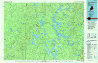
1994 Map of Chamberlain Lake
USGS Topo · Published 1994About this map
Chamberlain Lake and the surrounding North Maine Woods are captured here in a period of transition as timber management and conservation efforts defined the landscape. This 1994 update of mid-century data illustrates the vital network of waterways that served the logging industry, including the historic Tramway between Eagle Lake and Chamberlain Lake. The map highlights the sprawling reaches of the Allagash Wilderness Waterway and the Gero Island State Reserve Land, alongside established outposts like Churchill Depot and Chamberlain Farm. To the southeast, the boundary of Baxter State Park edges into a terrain of significant peaks such as Russell Mountain and Nuthedus Mountain. For researchers of Maine’s backcountry, the sheet provides a detailed record of the remote depots and landings, like Telos Landing, that once anchored the region's river-driven economy.
Find a feature on this map
80 named features on this map. Tap any name to fly to it.
Don’t see what you’re looking for? This feature index may not catch every label — zoom into the map to look around manually.
Map Details
Editions of this 1994 Chamberlain Lake Map
This is the sole edition of this map. No revisions or reprints were ever made.
Other maps of this area

1927 · Katahdin
USGS Topo · 1:48,000

1930 · Katahdin
USGS Topo · 1:62,500

1931 · Mooseleuk Lake
USGS Topo · 1:48,000

1932 · Umsaskis Lake
USGS Topo · 1:48,000

1932 · Musquacook Lakes
USGS Topo · 1:48,000

1935 · Umsaskis Lake
USGS Topo · 1:62,500

1935 · Musquacook Lakes
USGS Topo · 1:62,500

1935 · Mooseleuk Lake
USGS Topo · 1:62,500

1949 · Jackman
USGS Topo · 1:250,000

1949 · Katahdin
USGS Topo · 1:62,500