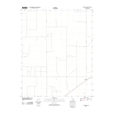
2010 Map of Chamberlin
USGS Topo · Published 2010About this map
Chamberlin is situated in the high plains of the Texas Panhandle, where a grid of local roads organizes the agricultural landscape of Dallam County. This 2010 survey illustrates the region’s reliance on a precise network of named thoroughfares like Andy James Rd and Chamberlin Rd to connect remote farmsteads and rural properties. The geometry of the landscape is defined by long, straight stretches such as 5m Ln and David Mack Ln, which slice through the terrain to serve scattered homesteads and irrigation systems. While the settlement of Chamberlin itself sits at a junction on the eastern edge of the quadrangle, the surrounding acreage is marked by local landmarks like Orchard Ln and Porter Ln, reflecting the family-based land ownership and local naming conventions typical of this productive farming district.
Find a feature on this map
8 named features on this map. Tap any name to fly to it.
Don’t see what you’re looking for? This feature index may not catch every label — zoom into the map to look around manually.
Map Details
Editions of this 2010 Chamberlin Map
This is the sole edition of this map. No revisions or reprints were ever made.
Other maps of this area

1954 · Dalhart
USGS Topo · 1:250,000

1958 · Dalhart
USGS Topo · 1:250,000

1962 · Dalhart
USGS Topo · 1:250,000

1964 · Stratford 2 SE
USGS Topo · 1:24,000

1965 · Wilco
USGS Topo · 1:24,000

1965 · Wilco NE
USGS Topo · 1:24,000

1973 · Bolin NE
USGS Topo · 1:24,000
1973 · Pritchard Ranch
USGS Topo · 1:24,000
1973 · Dalhart East
USGS Topo · 1:24,000
1973 · Dalhart West
USGS Topo · 1:24,000