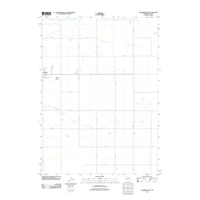
2011 Map of Chambers East
USGS Topo · Published 2011About this map
Chambers anchors the northwestern corner of this Holt County landscape, serving as a concentrated point of settlement within a sprawling agricultural grid. The village center is defined by the Chambers Post Office and nearby Perkins Memorial Airpark, illustrating the vital connection between local infrastructure and aviation in this part of Nebraska. Moving east from the town site, the terrain is shaped by the winding course of the South Fork Elkhorn River in the north and the meandering Dry Creek to the south. The map documents a rigid section-line road system, including Norvell St and S Victoria St, which carves the countryside into the characteristic rectangular blocks of the Great Plains, punctuated by small ponds and seasonal water features.
Find a feature on this map
20 named features on this map. Tap any name to fly to it.
Don’t see what you’re looking for? This feature index may not catch every label — zoom into the map to look around manually.
Map Details
Editions of this 2011 Chambers East Map
This is the sole edition of this map. No revisions or reprints were ever made.
Other maps of this area

1955 · O'Neill
USGS Topo · 1:250,000

1959 · O'Neill
USGS Topo · 1:250,000

1964 · O'Neill SE
USGS Topo · 1:24,000

1964 · Emmet SE
USGS Topo · 1:24,000

1964 · O'Neill SW
USGS Topo · 1:24,000

1969 · O'Neill
USGS Topo · 1:250,000

1981 · Goose Lake SW
USGS Topo · 1:24,000

1981 · Chambers East
USGS Topo · 1:24,000
1981 · Goose Lake NE
USGS Topo · 1:24,000
1981 · Goose Lake
USGS Topo · 1:24,000