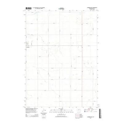
2014 Map of Chambers East
USGS Topo · Published 2014About this map
Chambers occupies the western edge of this High Plains landscape, situated at a junction where the town's street grid meets the expansive section-line road network of Holt County. The village is oriented along North Victoria Street and South Victoria Street, with residential blocks stretching toward North Norvell Street and North Park Street. Outside the settlement, the terrain is defined by the subtle drainage patterns of the South Fork Elkhorn River in the northwest and the wandering course of Dry Creek further south. This 2014 survey reveals a predominantly agricultural character, with long stretches of numbered corridors like 854th Road and 490th Avenue carving the prairie into the characteristic geometric pattern of the American Midwest, serving the remote farmsteads and rangelands typical of this region.
Find a feature on this map
25 named features on this map. Tap any name to fly to it.
Don’t see what you’re looking for? This feature index may not catch every label — zoom into the map to look around manually.
Map Details
Editions of this 2014 Chambers East Map
This is the sole edition of this map. No revisions or reprints were ever made.
Other maps of this area

1955 · O'Neill
USGS Topo · 1:250,000

1959 · O'Neill
USGS Topo · 1:250,000

1964 · O'Neill SE
USGS Topo · 1:24,000

1964 · Emmet SE
USGS Topo · 1:24,000

1964 · O'Neill SW
USGS Topo · 1:24,000

1969 · O'Neill
USGS Topo · 1:250,000

1981 · Goose Lake SW
USGS Topo · 1:24,000

1981 · Chambers East
USGS Topo · 1:24,000
1981 · Goose Lake NE
USGS Topo · 1:24,000
1981 · Goose Lake
USGS Topo · 1:24,000