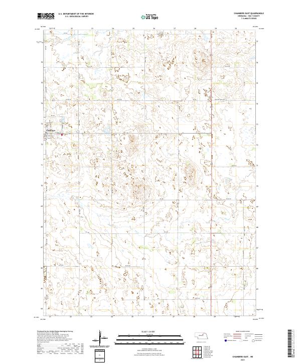
2021 Map of Chambers East
USGS Topo · Published 2021About this map
Chambers anchors the western edge of this Nebraska landscape, where the local street grid of E Main St, N Park St, and Norvell St meets the wide-open ranching country of Holt County. The terrain is defined by the drainage of the S Fork Elkhorn River in the northwest and Dry Cr to the southeast, illustrating the subtle hydrology of the Sandhills region. A rigid section-line road network, including Country Road 2260 and various numbered routes like 850th Rd, organizes the expansive plains into the established townships of t26n r12w and t25n r12w. This 2021 survey reflects a modern agricultural layout where traditional land divisions still dictate the path of travel through the valley.
Find a feature on this map
36 named features on this map. Tap any name to fly to it.
Don’t see what you’re looking for? This feature index may not catch every label — zoom into the map to look around manually.
Map Details
Editions of this 2021 Chambers East Map
This is the sole edition of this map. No revisions or reprints were ever made.
Other maps of this area

1955 · O'Neill
USGS Topo · 1:250,000

1959 · O'Neill
USGS Topo · 1:250,000

1964 · O'Neill SE
USGS Topo · 1:24,000

1964 · Emmet SE
USGS Topo · 1:24,000

1964 · O'Neill SW
USGS Topo · 1:24,000

1969 · O'Neill
USGS Topo · 1:250,000

1981 · Goose Lake SW
USGS Topo · 1:24,000

1981 · Chambers East
USGS Topo · 1:24,000
1981 · Goose Lake NE
USGS Topo · 1:24,000
1981 · Goose Lake
USGS Topo · 1:24,000