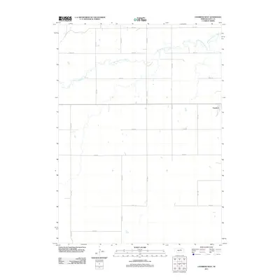
2011 Map of Chambers West
USGS Topo · Published 2011About this map
The South Fork Elkhorn River meanders across the northern half of this Holt County landscape, creating a distinct natural corridor through the otherwise structured agricultural grid. This portion of Nebraska is defined by its rectilinear road network, where routes like 857th Rd and 485th Ave mark the section lines of the rural prairie. On the eastern edge of the survey, the village of Chambers provides a localized center of activity, with its street grid including C St. The topography is relatively level, typical of the Elkhorn River valley, with numerous small depressions and drainage patterns visible between the primary transit corridors. This map documents the rural infrastructure and hydrological features of the region as they existed in the early 21st century.
Find a feature on this map
16 named features on this map. Tap any name to fly to it.
Don’t see what you’re looking for? This feature index may not catch every label — zoom into the map to look around manually.
Map Details
Editions of this 2011 Chambers West Map
This is the sole edition of this map. No revisions or reprints were ever made.
Other maps of this area

1955 · O'Neill
USGS Topo · 1:250,000

1959 · O'Neill
USGS Topo · 1:250,000

1964 · Emmet SE
USGS Topo · 1:24,000

1964 · Emmet SW
USGS Topo · 1:24,000

1964 · O'Neill SW
USGS Topo · 1:24,000

1969 · O'Neill
USGS Topo · 1:250,000

1981 · Amelia
USGS Topo · 1:24,000

1981 · Goose Lake SW
USGS Topo · 1:24,000

1981 · Chambers East
USGS Topo · 1:24,000
1981 · Miles Ranch
USGS Topo · 1:24,000