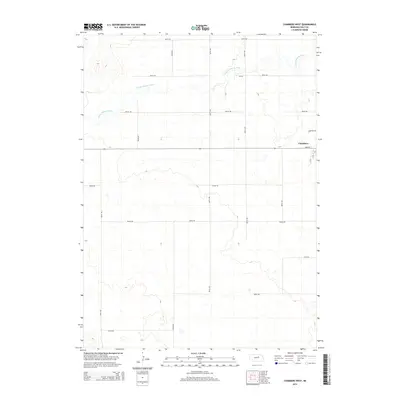
2014 Map of Chambers West
USGS Topo · Published 2014About this map
Chambers occupies the northeastern edge of this landscape, serving as a primary point of settlement where Main St, S B St, and S C St form the village core. The surrounding Holt County terrain is defined by the winding course of the S Fork Elkhorn River, which meanders across the northern half of the map, carving a distinct riparian corridor through the Nebraska plains.
Find a feature on this map
21 named features on this map. Tap any name to fly to it.
Don’t see what you’re looking for? This feature index may not catch every label — zoom into the map to look around manually.
Map Details
Editions of this 2014 Chambers West Map
This is the sole edition of this map. No revisions or reprints were ever made.
Other maps of this area

1955 · O'Neill
USGS Topo · 1:250,000

1959 · O'Neill
USGS Topo · 1:250,000

1964 · Emmet SE
USGS Topo · 1:24,000

1964 · Emmet SW
USGS Topo · 1:24,000

1964 · O'Neill SW
USGS Topo · 1:24,000

1969 · O'Neill
USGS Topo · 1:250,000

1981 · Amelia
USGS Topo · 1:24,000

1981 · Goose Lake SW
USGS Topo · 1:24,000

1981 · Chambers East
USGS Topo · 1:24,000
1981 · Miles Ranch
USGS Topo · 1:24,000