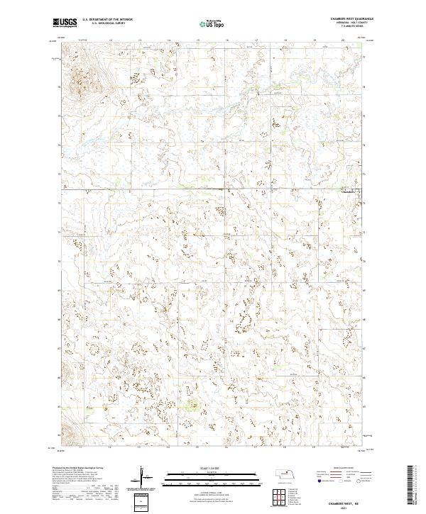
2021 Map of Chambers West
USGS Topo · Published 2021About this map
The S Fork Elkhorn River winds through this section of Holt County, defining a landscape shaped by hydrology and the Public Land Survey System. The eastern edge of the village of Chambers is visible, centered on Main St, serving as a focal point for the surrounding ranching and agricultural lands. The terrain is organized by a precise grid of rural routes, including north-south corridors like 481st Ave and 486th Ave, and east-west thoroughfares such as 857 Rd and 850th Rd. This 2021 survey illustrates how modern infrastructure follows the township and range lines established decades earlier, specifically across t26n r13w and t25n r12w. The numerous small wetlands and drainage patterns associated with the river fork highlight the complex water management required in this part of the Nebraska Sandhills periphery.
Find a feature on this map
22 named features on this map. Tap any name to fly to it.
Don’t see what you’re looking for? This feature index may not catch every label — zoom into the map to look around manually.
Map Details
Editions of this 2021 Chambers West Map
This is the sole edition of this map. No revisions or reprints were ever made.
Other maps of this area

1955 · O'Neill
USGS Topo · 1:250,000

1959 · O'Neill
USGS Topo · 1:250,000

1964 · Emmet SE
USGS Topo · 1:24,000

1964 · Emmet SW
USGS Topo · 1:24,000

1964 · O'Neill SW
USGS Topo · 1:24,000

1969 · O'Neill
USGS Topo · 1:250,000

1981 · Amelia
USGS Topo · 1:24,000

1981 · Goose Lake SW
USGS Topo · 1:24,000

1981 · Chambers East
USGS Topo · 1:24,000
1981 · Miles Ranch
USGS Topo · 1:24,000