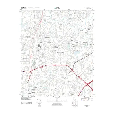
2011 Map of Chamblee
USGS Topo · Published 2011About this map
Chamblee and Doraville anchor the southern portion of this landscape, characterized by the dense suburban growth and industrial infrastructure of the early 21st century. The northern boundary is defined by the winding course of the Chattahoochee River, featuring Island Bar Shoals and the Holcomb Bridge Post Office. This era shows a complex network of residential subdivisions such as Dunwoody Heights, Chestnut Forest, and North Peachtree Woods, which have largely filled the spaces between historic thoroughfares like Peachtree Industrial Blvd.
Find a feature on this map
140 named features on this map. Tap any name to fly to it.
Don’t see what you’re looking for? This feature index may not catch every label — zoom into the map to look around manually.
Map Details
Editions of this 2011 Chamblee Map
This is the sole edition of this map. No revisions or reprints were ever made.
Other maps of this area

1888 · Atlanta
USGS Topo · 1:125,000

1890 · Suwanee
USGS Topo · 1:125,000

1890 · Atlanta
USGS Topo · 1:125,000

1892 · Atlanta
USGS Topo · 1:125,000

1894 · Suwanee
USGS Topo · 1:125,000

1895 · Atlanta
USGS Topo · 1:125,000

1953 · Atlanta
USGS Topo · 1:250,000

1954 · Chamblee
USGS Topo · 1:24,000

1954 · Decatur
USGS Topo · 1:24,000

1954 · Bolton
USGS Topo · 1:24,000