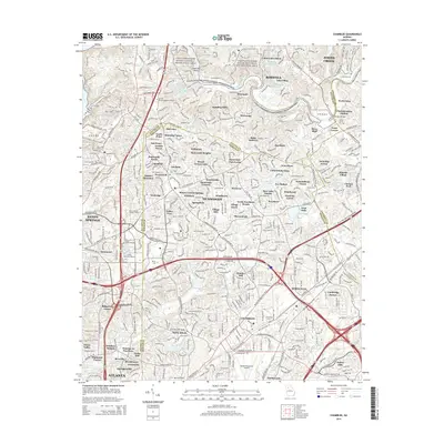
2014 Map of Chamblee
USGS Topo · Published 2014About this map
Chattahoochee River National Recreation Area lands border the northern reaches of this suburban corridor, preserving riverfront terrain near Island Bar Shoals and Horseshoe Bend. The landscape transitions from the protected river banks to the dense residential developments of Dunwoody and Johns Creek, illustrating the extensive growth along the Fulton, DeKalb, and Gwinnett county lines by the early 21st century. High-traffic arteries including Ga 400 and I-285 define the transit network, while the CSX Transportation line serves the industrial and commercial zones near Chamblee. Institutional footprints are prominent, from the sprawling Dekalb-Peachtree Airport to Oglethorpe University and several satellite campuses. Smaller historic markers remain among the modern subdivisions, including the New Hope Cem and Martin Cem, providing genealogical touchpoints in a rapidly evolving metropolitan area.
Find a feature on this map
114 named features on this map. Tap any name to fly to it.
Don’t see what you’re looking for? This feature index may not catch every label — zoom into the map to look around manually.
Map Details
Editions of this 2014 Chamblee Map
This is the sole edition of this map. No revisions or reprints were ever made.
Other maps of this area

1888 · Atlanta
USGS Topo · 1:125,000

1890 · Suwanee
USGS Topo · 1:125,000

1890 · Atlanta
USGS Topo · 1:125,000

1892 · Atlanta
USGS Topo · 1:125,000

1894 · Suwanee
USGS Topo · 1:125,000

1895 · Atlanta
USGS Topo · 1:125,000

1953 · Atlanta
USGS Topo · 1:250,000

1954 · Chamblee
USGS Topo · 1:24,000

1954 · Decatur
USGS Topo · 1:24,000

1954 · Bolton
USGS Topo · 1:24,000