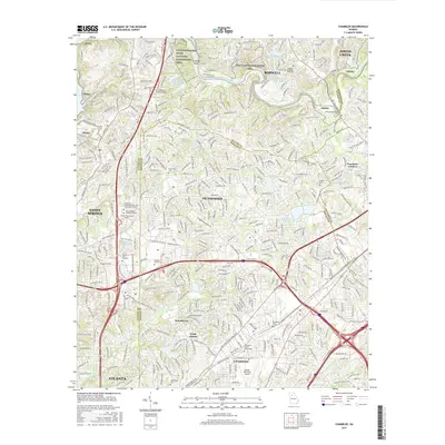
2017 Map of Chamblee
USGS Topo · Published 2017About this map
The Chattahoochee River carves a winding path through this suburban landscape, featuring Island Bar Shoals and the expansive Bull Sluice Lake to the west. This 2017 survey illustrates the dense development of northern Atlanta and its surrounding communities, including Chamblee, Dunwoody, and Brookhaven. The area is a hub of higher education, shown by the campuses of Oglethorpe Univ and The Art Institute of Atlanta.
Find a feature on this map
50 named features on this map. Tap any name to fly to it.
Don’t see what you’re looking for? This feature index may not catch every label — zoom into the map to look around manually.
Map Details
Editions of this 2017 Chamblee Map
This is the sole edition of this map. No revisions or reprints were ever made.
Other maps of this area

1888 · Atlanta
USGS Topo · 1:125,000

1890 · Suwanee
USGS Topo · 1:125,000

1890 · Atlanta
USGS Topo · 1:125,000

1892 · Atlanta
USGS Topo · 1:125,000

1894 · Suwanee
USGS Topo · 1:125,000

1895 · Atlanta
USGS Topo · 1:125,000

1953 · Atlanta
USGS Topo · 1:250,000

1954 · Chamblee
USGS Topo · 1:24,000

1954 · Decatur
USGS Topo · 1:24,000

1954 · Bolton
USGS Topo · 1:24,000