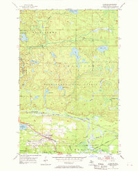
1955 Map of Champion
USGS Topo · Published 1970About this map
The railroad community of Champion serves as the focal point of this mid-century survey, situated at a critical junction of Upper Peninsula transportation lines. The Duluth South Shore and Atlantic Railroad and the Chicago and North Western corridor dominate the southern landscape, tracing the topography near Lake Michigamme. Small settlements and named landings like Beacon, Wabic, and Martins Landing cluster along these rail routes and the shorelines, reflecting an era when industrial transit and lake access drove local development.
Find a feature on this map
36 named features on this map. Tap any name to fly to it.
Don’t see what you’re looking for? This feature index may not catch every label — zoom into the map to look around manually.
Map Details
Editions of this 1955 Champion Map
Other maps of this area

1899 · Witbeck
USGS Topo · 1:62,500

1955 · Champion
USGS Topo · 1:24,000

1955 · Diorite
USGS Topo · 1:24,000

1955 · Witch Lake NE
USGS Topo · 1:24,000

1955 · Greenwood
USGS Topo · 1:24,000

1955 · Republic
USGS Topo · 1:62,500

1955 · Republic
USGS Topo · 1:24,000

1955 · Witch Lake
USGS Topo · 1:62,500

1955 · Champion
USGS Topo · 1:62,500

1956 · Michigamme
USGS Topo · 1:62,500